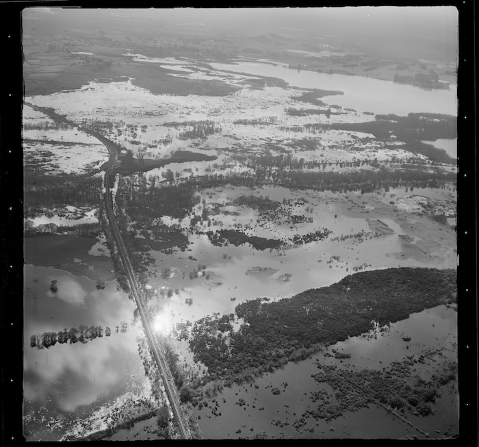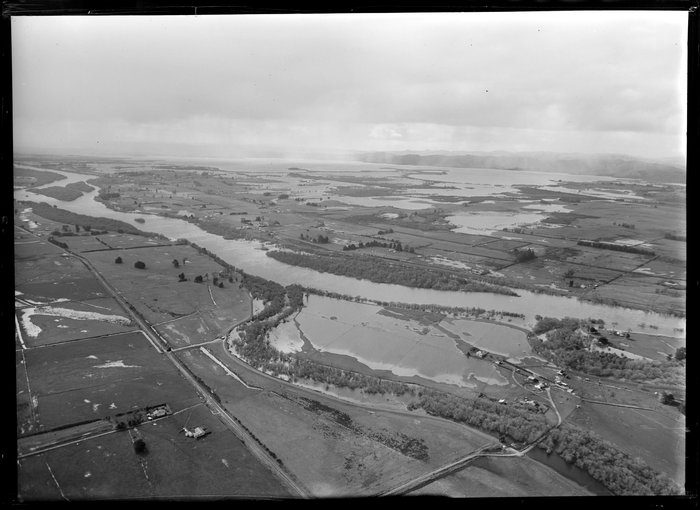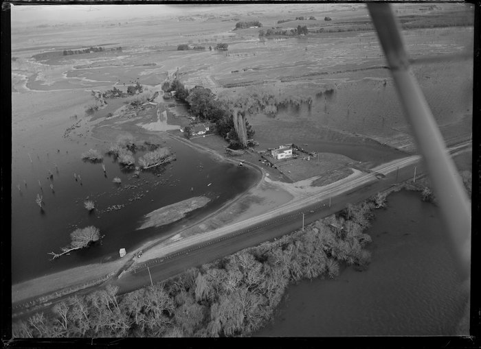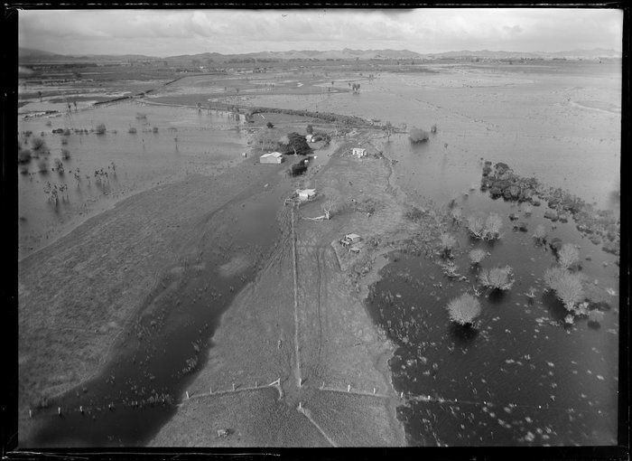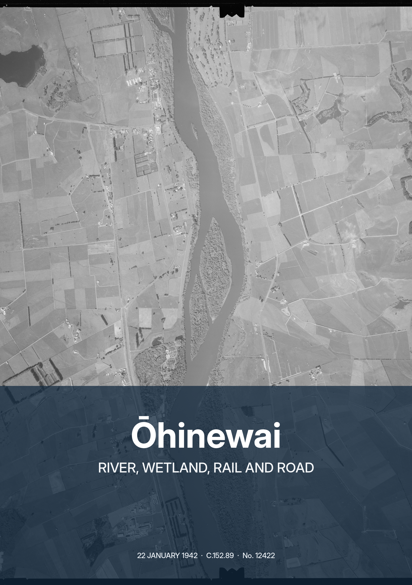
Ōhinewai and the Waikato River, 22 January 1942
Ōhinewai and the Waikato River, 22 January 1942, frame C.152.89, No. 12422. Project-held original aerial.
Project-held 1942 aerial; frame C.152.89, No. 12422.
Download original imageImage gallery
The book gallery shows seven images from the publication. The archive gallery includes eight Whites Aviation aerials from 1954–1964, a 1940 Ōhinewai aerial, three railway photographs from 1964 and three 1917 photographs of the Pukemiro coalfield. Pukemiro is regional context; those images show the mine and collieries, not the Ōhinewai village.
Ōhinewai and the Waikato River, 22 January 1942, frame C.152.89, No. 12422. Project-held original aerial.
Project-held 1942 aerial; frame C.152.89, No. 12422.
Download original image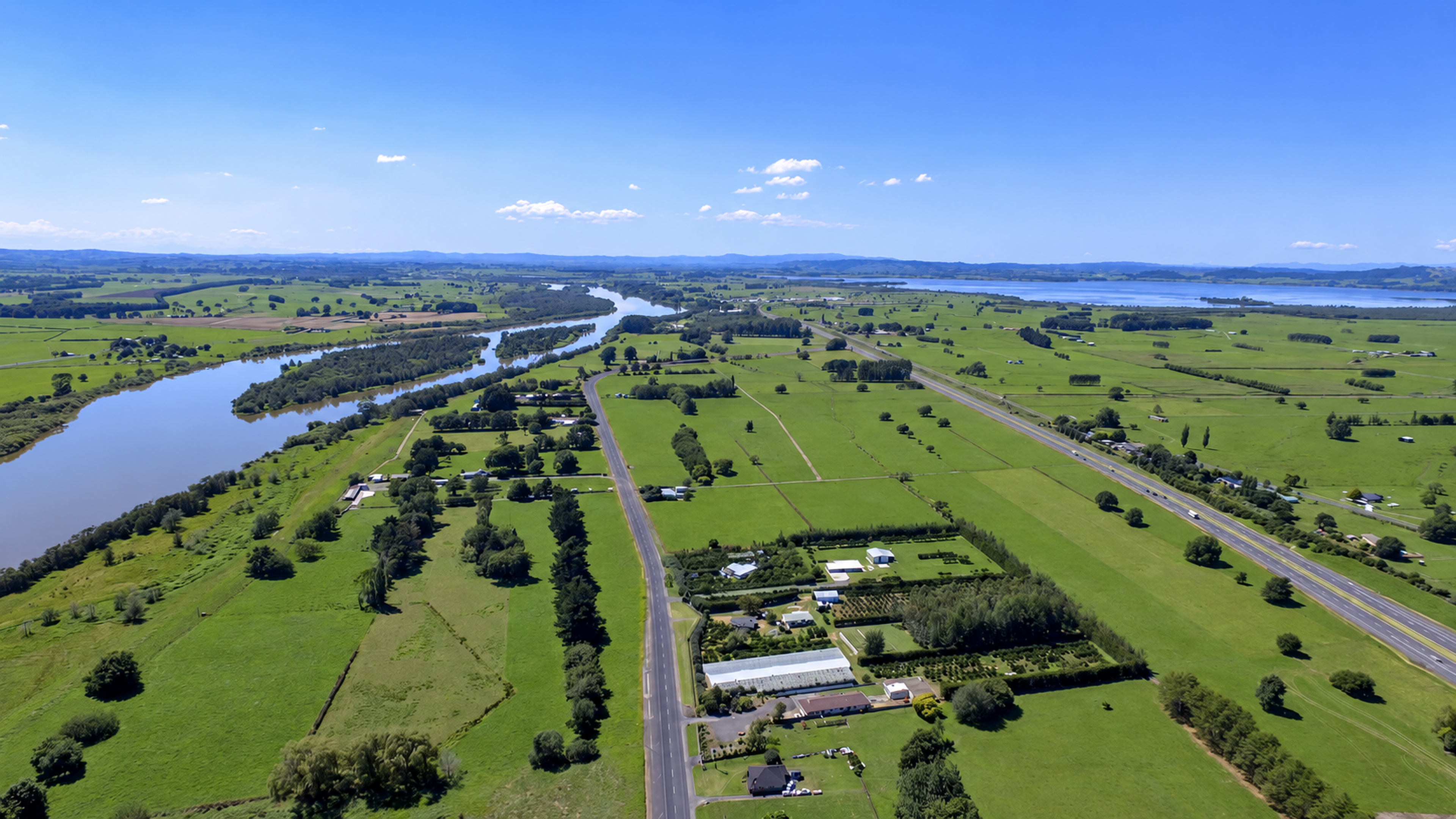
Modern aerial view of Ōhinewai, with the Waikato River at left, the former State Highway 1 corridor through the centre, and the Waikato Expressway at right.
Project-held 4K modern aerial.
Download original image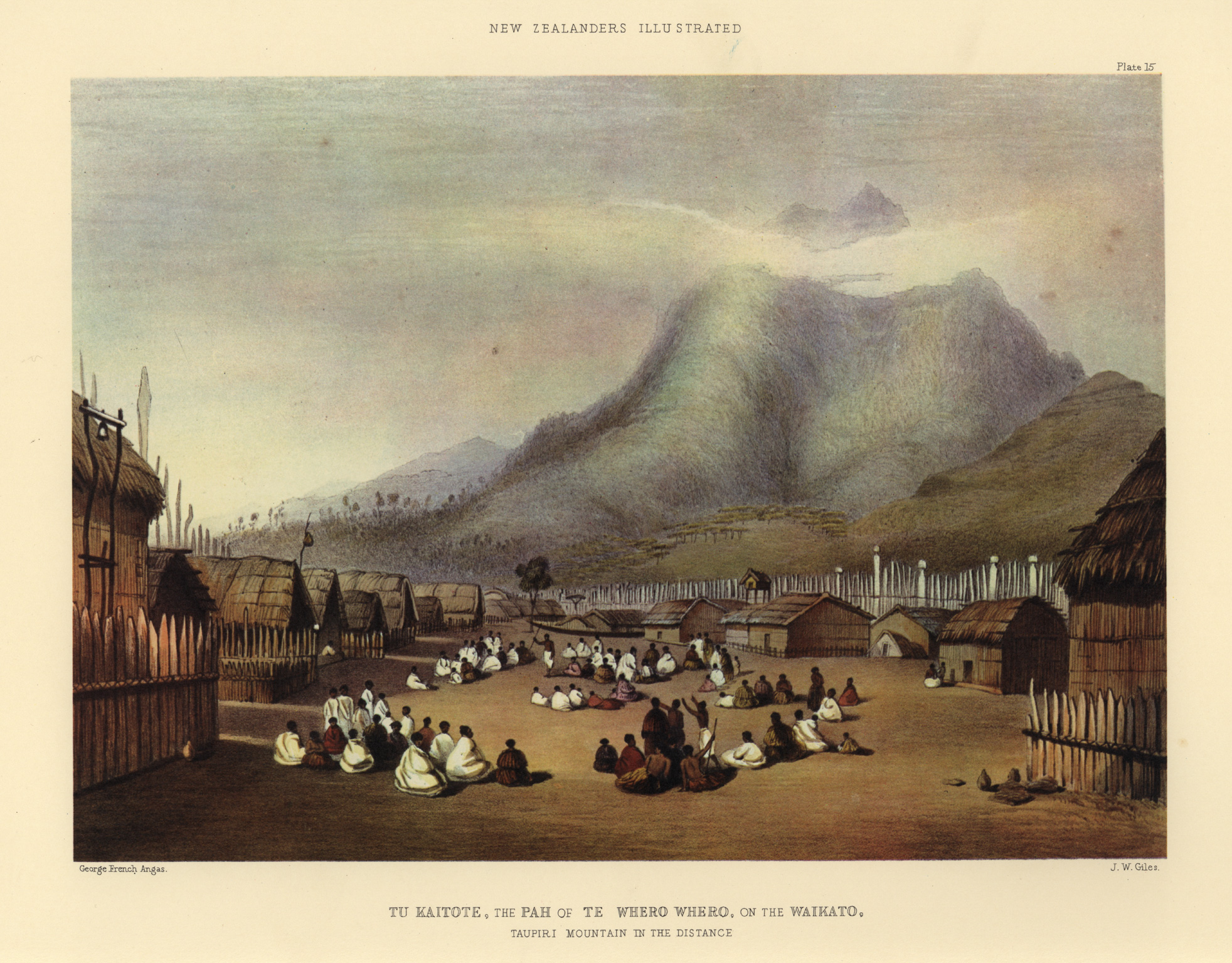
George French Angas’s Waikato river-landscape view at Tu Kaitote/Taupiri, drawn in 1844 and published as a lithograph in The New Zealanders Illustrated in 1847. Regional lower-Waikato context only: this is not an Ōhinewai view.
George French Angas and J. W. Giles; public-domain work, Wikimedia Commons reproduction.
Download original image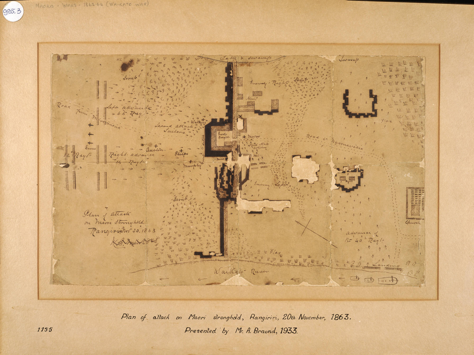
Plan of attack on the Māori stronghold at Rangiriri, 20 November 1863. Rangiriri lies about eight kilometres north of Ōhinewai and was the major battle site in this part of the lower Waikato corridor.
Auckland Libraries Heritage Collections, Map 4624.
Download original image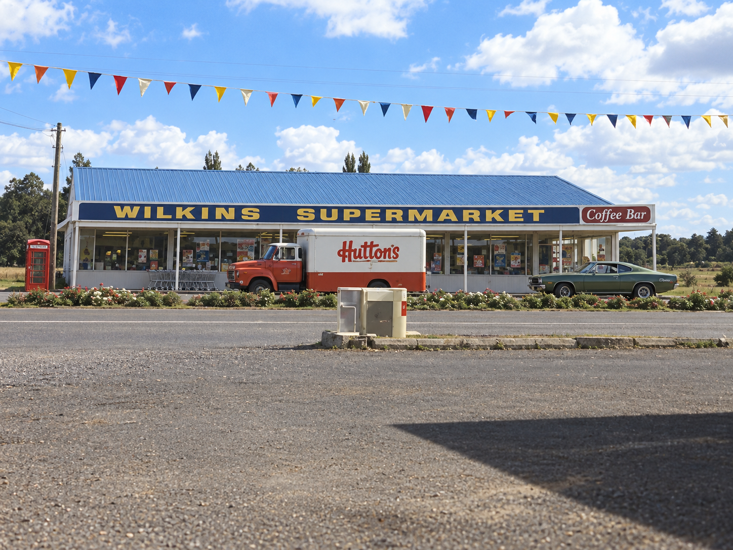
Reconstruction of Wilkins Supermarket in the 1970s, based on the surviving family photograph. This is a reconstruction, not a historical photograph. Colours and some foreground details have been reconstructed.
Reconstruction based on a surviving Wilkins family photograph.
Download original image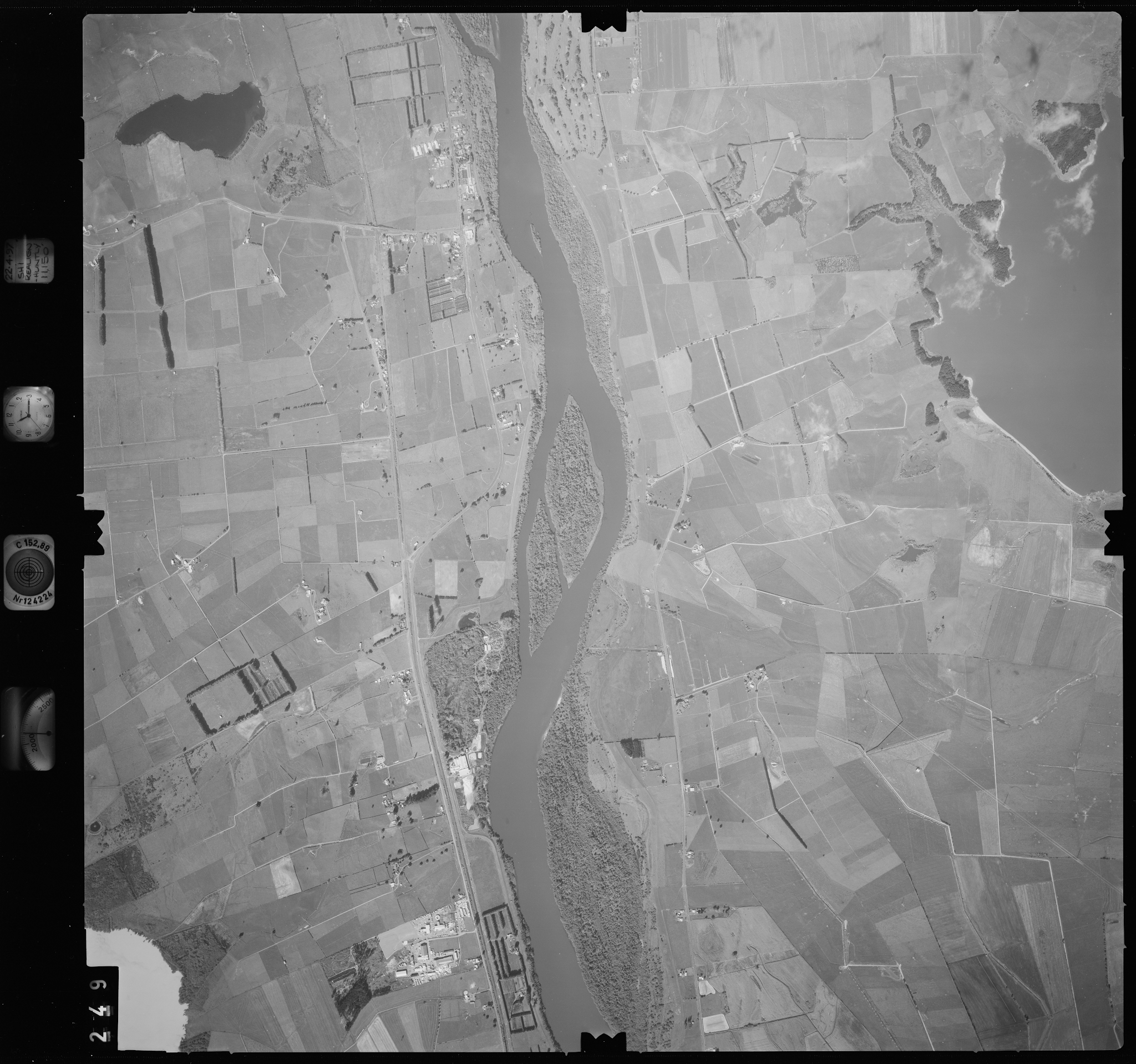
Ōhinewai before the 2003 State Highway 1 bypass. The source email identifies this Crown aerial as Ōhinewai, 1997, and it shows the settlement while through traffic still followed the old highway corridor.
Recovered Crown aerial, CROWN_Temp132X_2961_210.jpg.
Download original image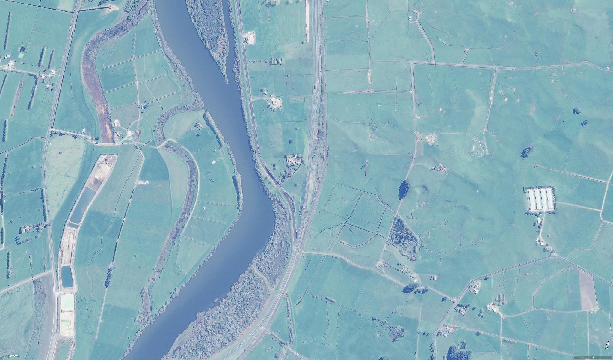
Ōhinewai after the bypass, from a Google Earth source file saved in 2014. The divided highway is visible, but the underlying imagery acquisition date has not been verified.
Google Earth source file saved 7 July 2014.
Download original imageAlexander Turnbull Library · Whites Aviation
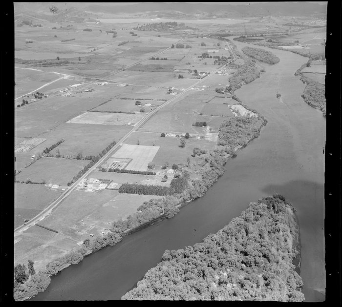
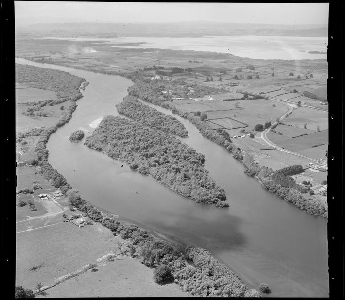
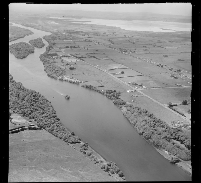
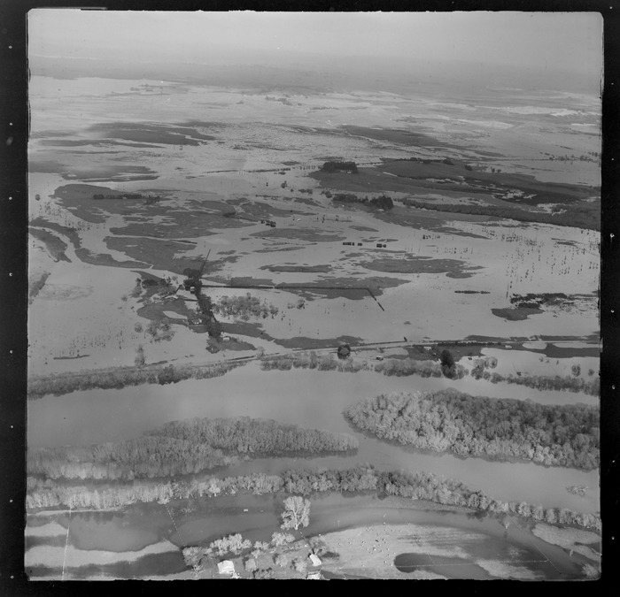
Eight National Library photographs show the Waikato River, Lake Rotongaro and flooding at Rangiriri and Ōhinewai. Each card presents a colourised interpretation alongside the black-and-white source download, attribution and National Library record. The item records provide free downloads under CC BY 4.0; the colours are interpretive.
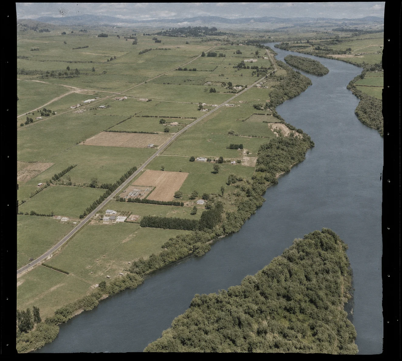
WA-36062-F · 29 October 1954
AI-colourised interpretation of this Whites Aviation aerial. The black-and-white source image is available on the National Library record; colours are interpretive.
Ohinewai, Waikato District, showing Waikato River. Whites Aviation Ltd: Photographs. Ref: WA-36062-F. Alexander Turnbull Library, Wellington, New Zealand. AI-colourised interpretation; colours are interpretive.
Free download · CC BY 4.0. National Library item record and high-resolution download.
Download black-and-white source file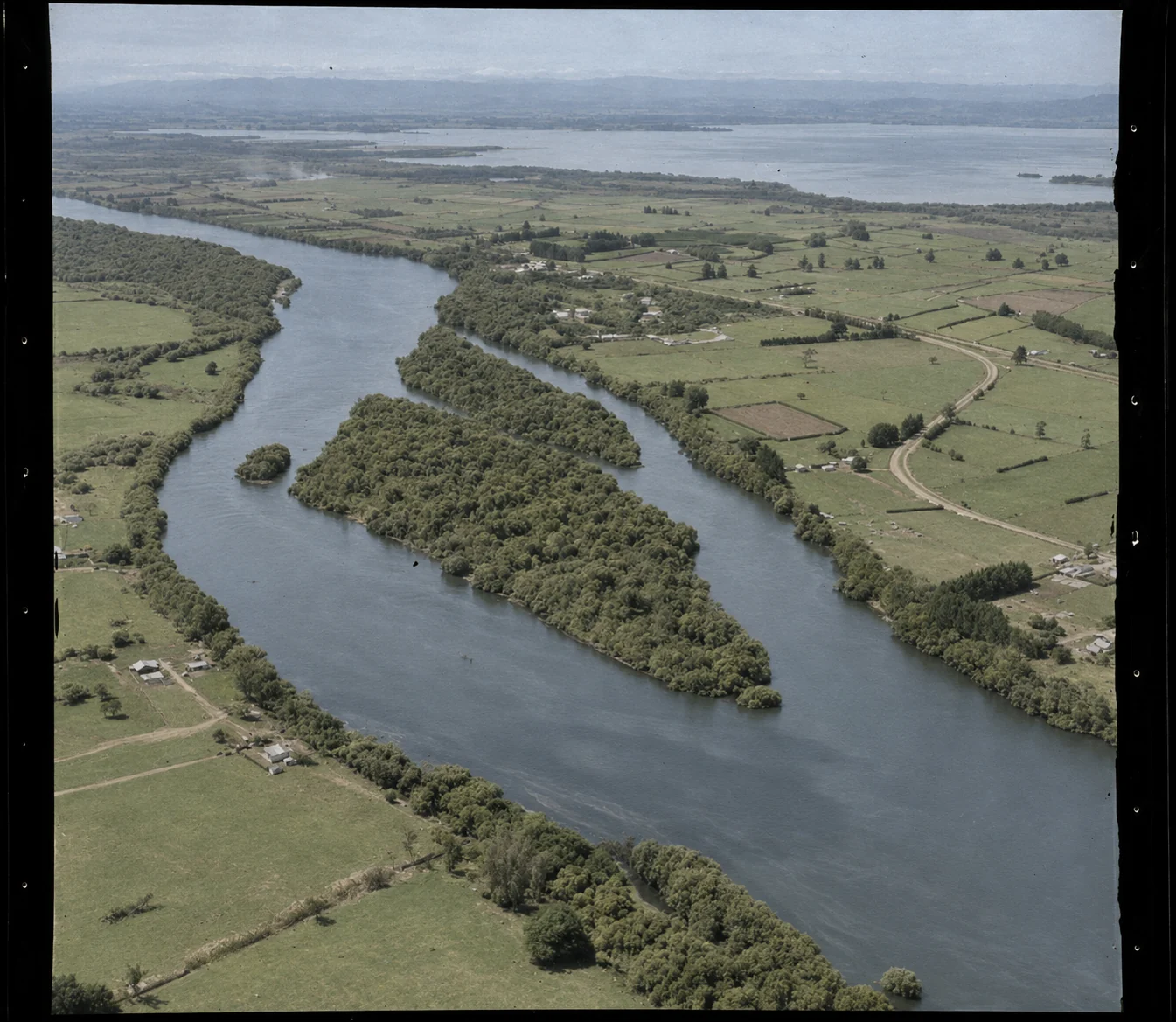
WA-36063-F · 29 October 1954
AI-colourised interpretation of this second Whites Aviation aerial. The black-and-white source image is available on the National Library record; colours are interpretive.
Ohinewai, Waikato District, showing Waikato River. Whites Aviation Ltd: Photographs. Ref: WA-36063-F. Alexander Turnbull Library, Wellington, New Zealand. AI-colourised interpretation; colours are interpretive.
Free download · CC BY 4.0. National Library item record and high-resolution download.
Download black-and-white source file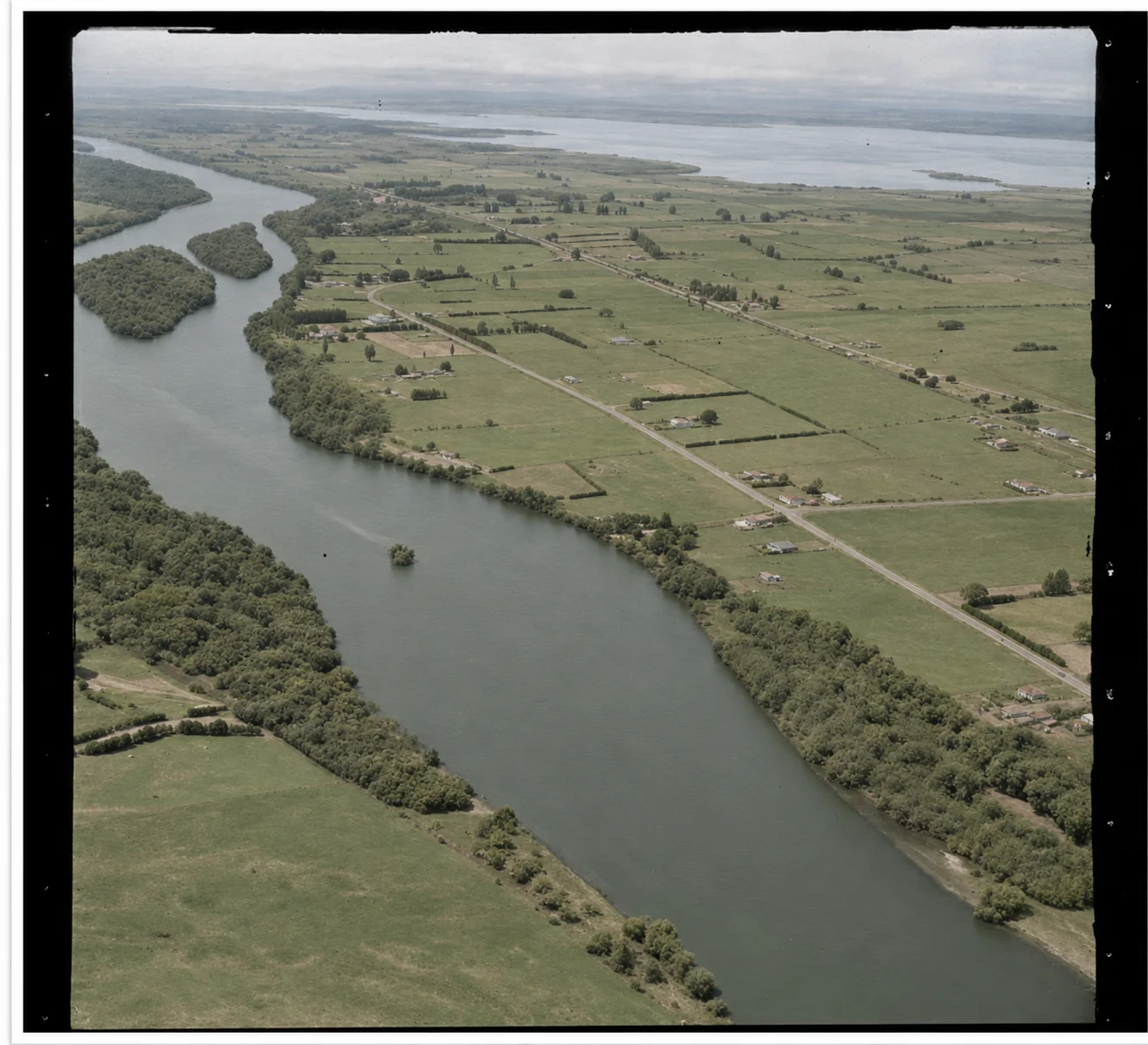
WA-36064-F · 29 October 1954
AI-colourised interpretation of this Whites Aviation aerial. The black-and-white source image is available on the National Library record; colours in this version are interpretive.
Ohinewai, Waikato District, showing Waikato River and Lake Rotongaro. Whites Aviation Ltd: Photographs. Ref: WA-36064-F. Alexander Turnbull Library, Wellington, New Zealand. AI-colourised interpretation; colours are interpretive.
Free download · CC BY 4.0. National Library item record and high-resolution download.
Download black-and-white source file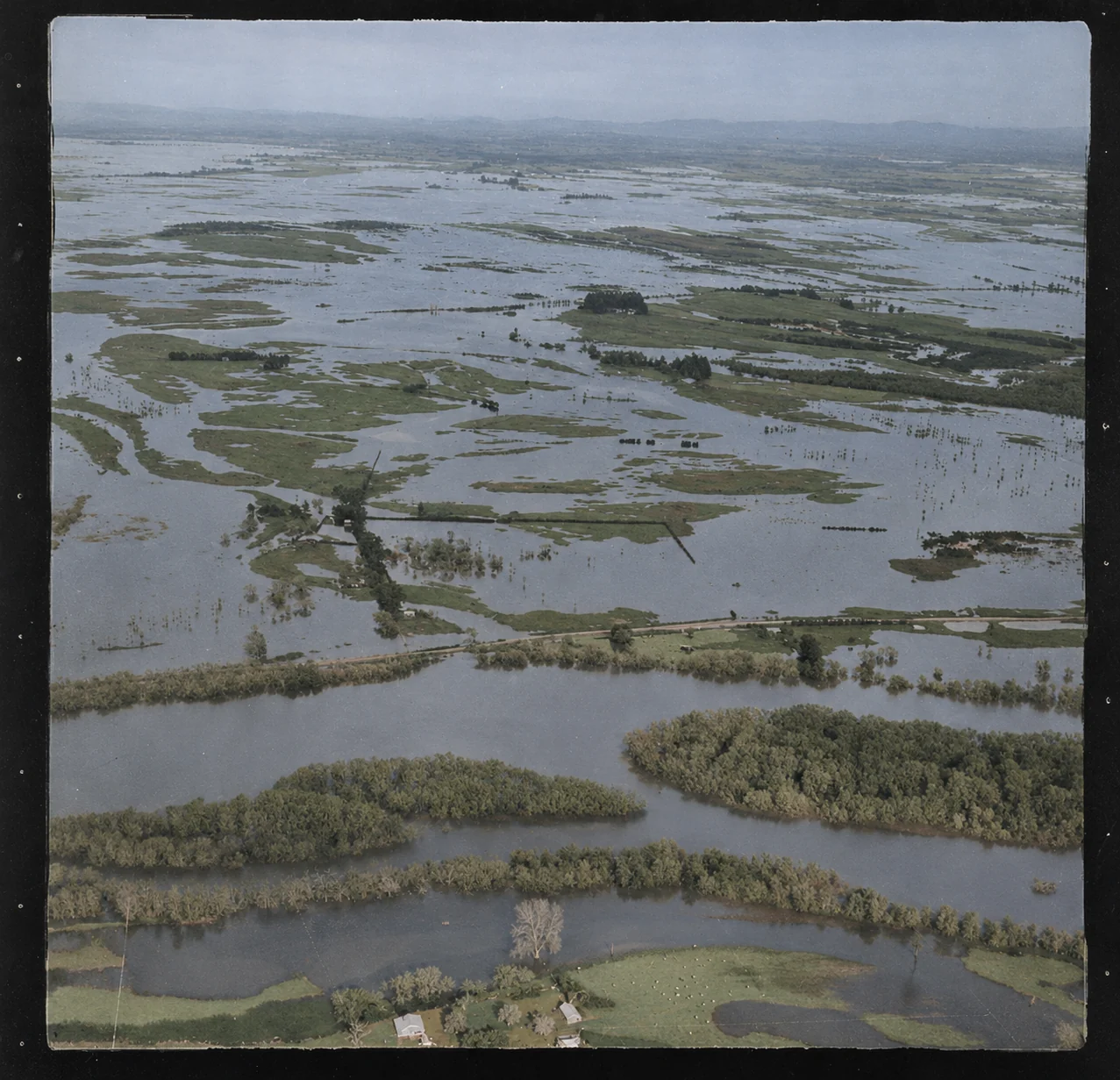
WA-41807-F · 5 July 1956
AI-colourised interpretation of Whites Aviation’s aerial photograph of flooding at Rangiriri and Ōhinewai on 5 July 1956. The National Library record provides the black-and-white source; colours are interpretive.
Flooding at Rangiriri and Ohinewai, Waikato district. Whites Aviation Ltd: Photographs. Ref: WA-41807-F. Alexander Turnbull Library, Wellington, New Zealand. AI-colourised interpretation; colours are interpretive.
Free download · CC BY 4.0. National Library item record and high-resolution download.
Download black-and-white source file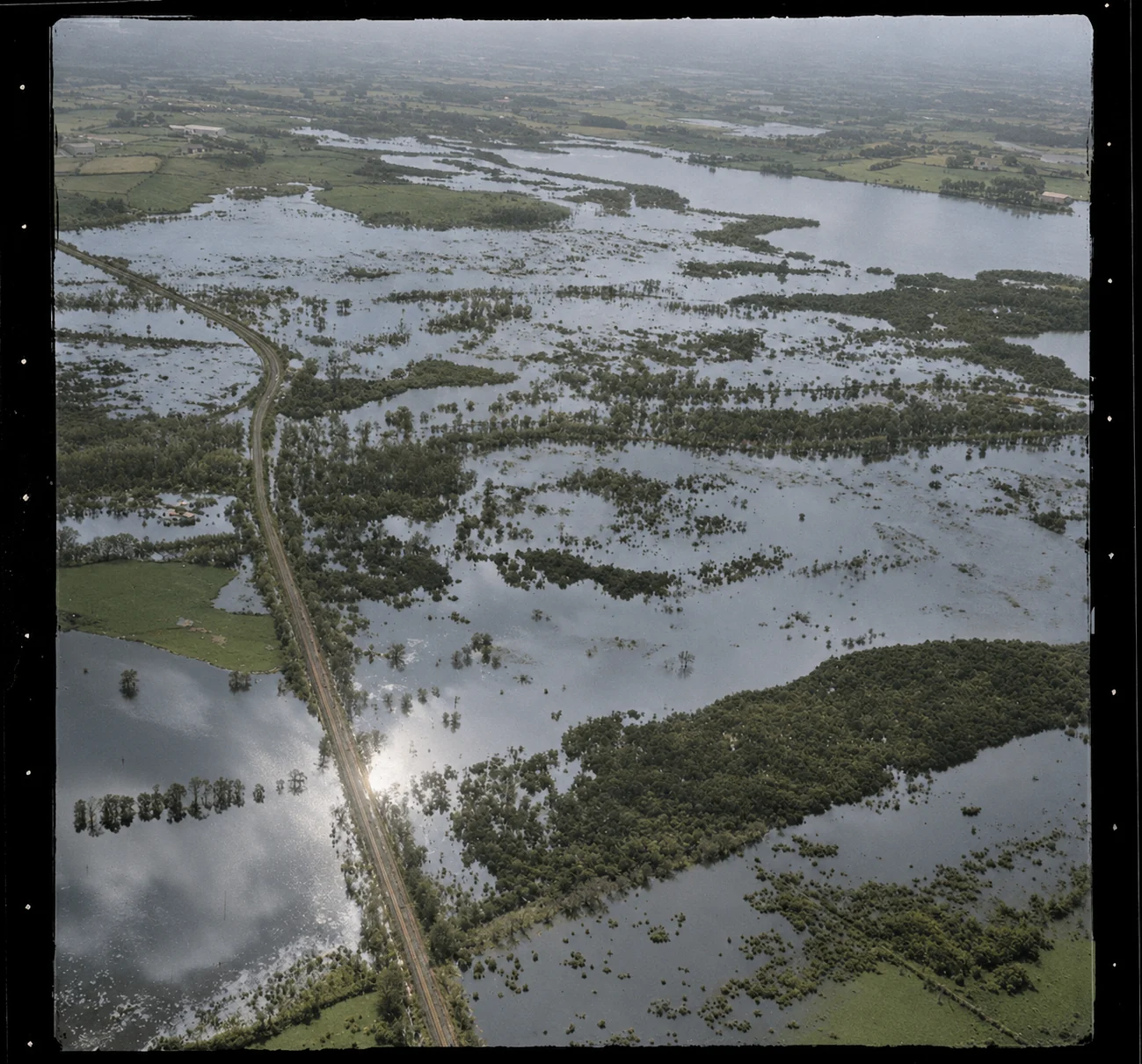
WA-41808-F · 5 July 1956
AI-colourised interpretation of Whites Aviation’s aerial view of flooding at Rangiriri and Ōhinewai on 5 July 1956. The black-and-white source is on the National Library record; colours are interpretive.
Flooding at Rangiriri and Ohinewai, Waikato District. Whites Aviation Ltd: Photographs. Ref: WA-41808-F. Alexander Turnbull Library, Wellington, New Zealand. AI-colourised interpretation; colours are interpretive.
Free download · CC BY 4.0. National Library item record and high-resolution download.
Download black-and-white source file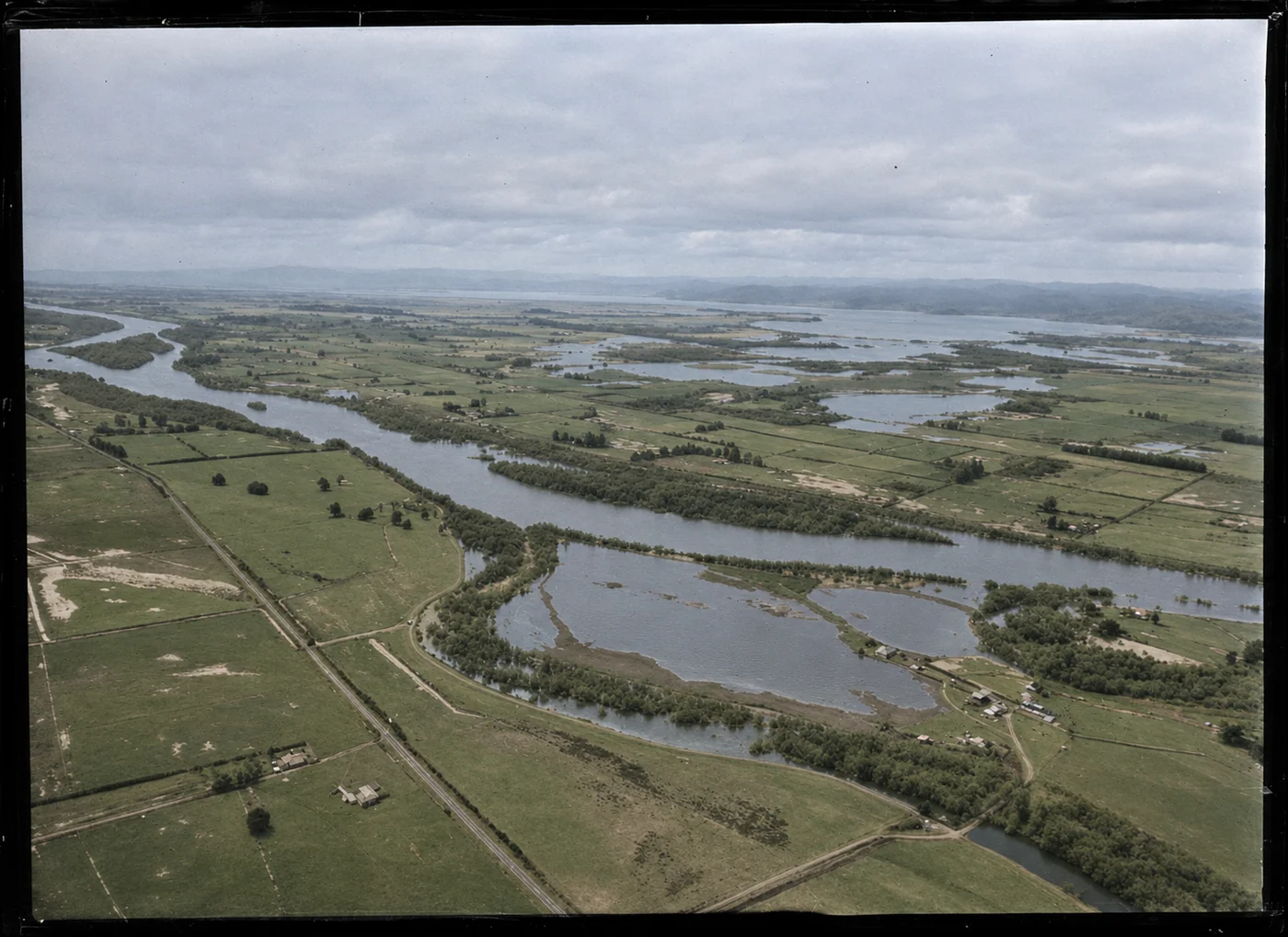
WA-62340-G · 28 July 1964
AI-colourised interpretation of Whites Aviation’s aerial photograph catalogued as Waikato River, Ohinewai, dated 28 July 1964. Colours are interpretive; the black-and-white source is on the National Library record.
Waikato River, Ohinewai. Whites Aviation Ltd: Photographs. Ref: WA-62340-G. Alexander Turnbull Library, Wellington, New Zealand. AI-colourised interpretation; colours are interpretive.
Free download · CC BY 4.0. National Library item record and high-resolution download.
Download black-and-white source file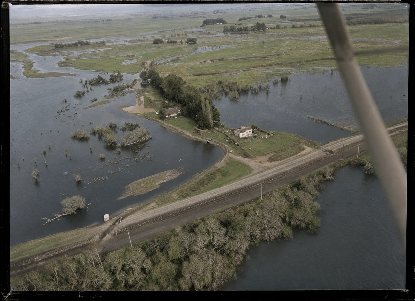
WA-62345-G · 28 July 1964
AI-colourised interpretation of this Whites Aviation aerial photograph. The black-and-white source is on the National Library record; colours are interpretive.
Waikato River, Ohinewai. Whites Aviation Ltd: Photographs. Ref: WA-62345-G. Alexander Turnbull Library, Wellington, New Zealand. AI-colourised interpretation; colours are interpretive.
Free download · CC BY 4.0. National Library item record and high-resolution download.
Download black-and-white source file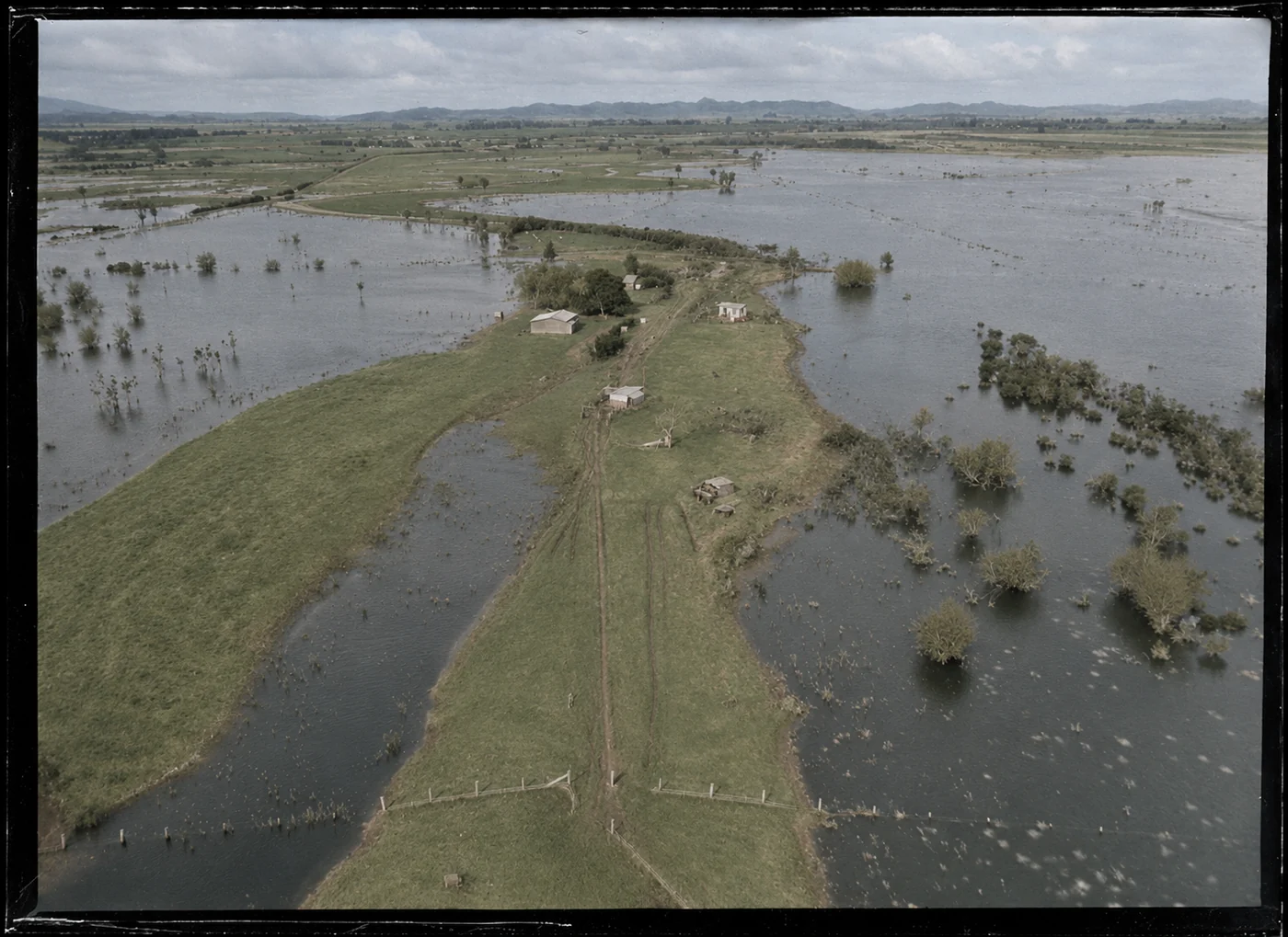
WA-62350-G · 28 July 1964
AI-colourised interpretation of this Whites Aviation aerial photograph. The black-and-white source is on the National Library record; colours are interpretive.
Waikato River, Ohinewai. Whites Aviation Ltd: Photographs. Ref: WA-62350-G. Alexander Turnbull Library, Wellington, New Zealand. AI-colourised interpretation; colours are interpretive.
Free download · CC BY 4.0. National Library item record and high-resolution download.
Download black-and-white source fileLINZ · Weston Langford · Alexander Turnbull Library
These finds add a 1940 aerial of Ōhinewai and three photographs of trains at Ōhinewai on 15 January 1964. The 1917 Godber photographs show the mine, coal handling and locomotive at Pukemiro, regional context for the district’s coal and rail history rather than images of the Ōhinewai village.
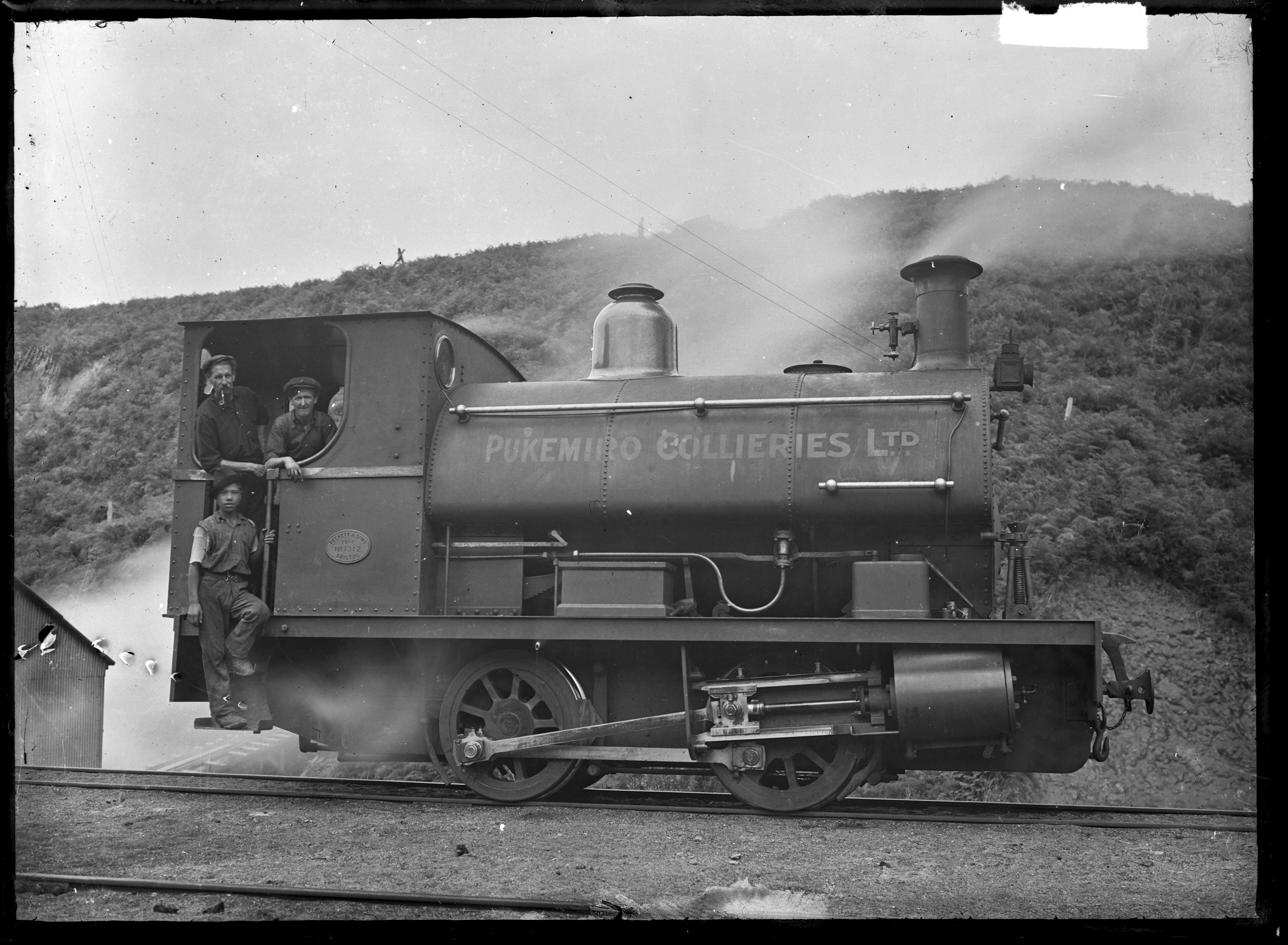
APG-0480-1/2-G · 1917 · Pukemiro
The 1914 Peckett locomotive was photographed at Pukemiro by Albert Percy Godber in 1917. This is a district image, rather than a view of Ōhinewai village.
Godber Collection, Alexander Turnbull Library. Ref: APG-0480-1/2-G.
Public Domain Mark 1.0 in New Zealand. Reproduced unmodified. Wikimedia Commons file and reuse details · National Library item record.
Download original image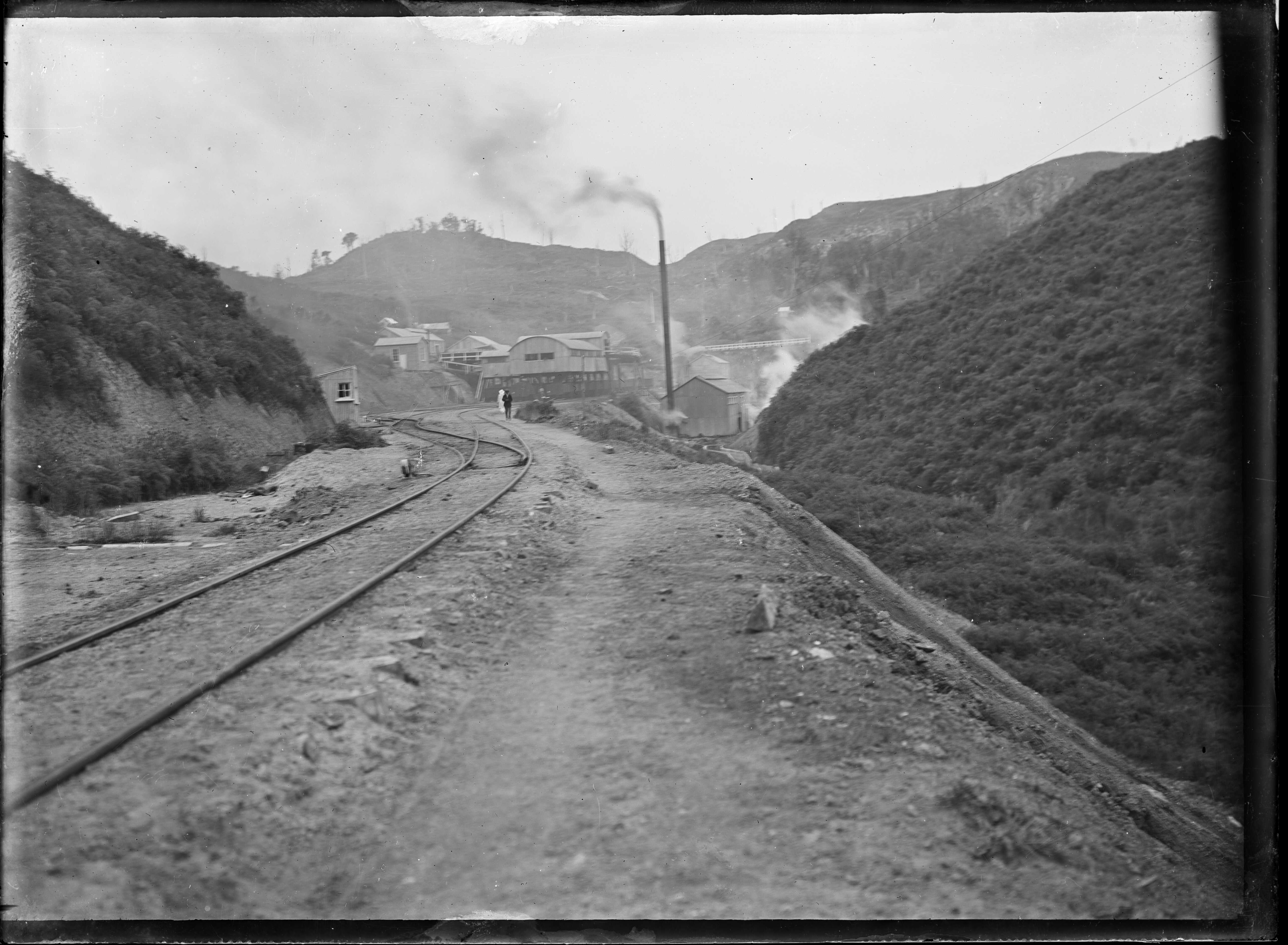
APG-0488-1/2-G · 1917 · Pukemiro
Godber’s photograph shows the mine approach and its hillside railway. Pukemiro is shown as regional mining context, not as Ōhinewai village.
Godber Collection, Alexander Turnbull Library. Ref: APG-0488-1/2-G.
Public Domain Mark 1.0 in New Zealand. Reproduced unmodified. Wikimedia Commons file and reuse details · National Library item record.
Download original image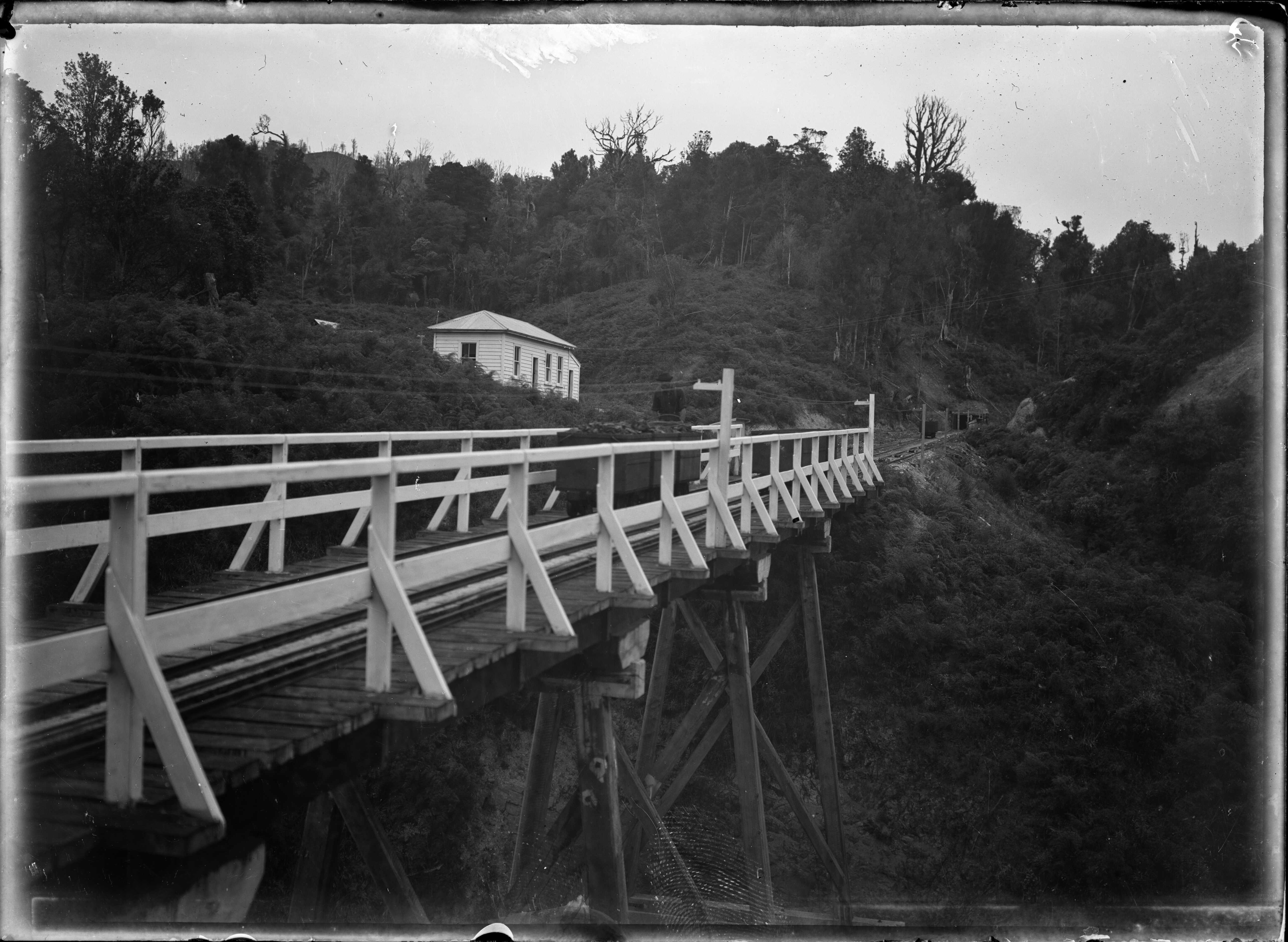
APG-0487-1/2-G · 1917 · Pukemiro
Godber photographed the mine’s coal handling equipment in 1917. The image records Pukemiro’s mining operation and is included as district context.
Godber Collection, Alexander Turnbull Library. Ref: APG-0487-1/2-G.
Public Domain Mark 1.0 in New Zealand. Reproduced unmodified. Wikimedia Commons file and reuse details · National Library item record.
Download original image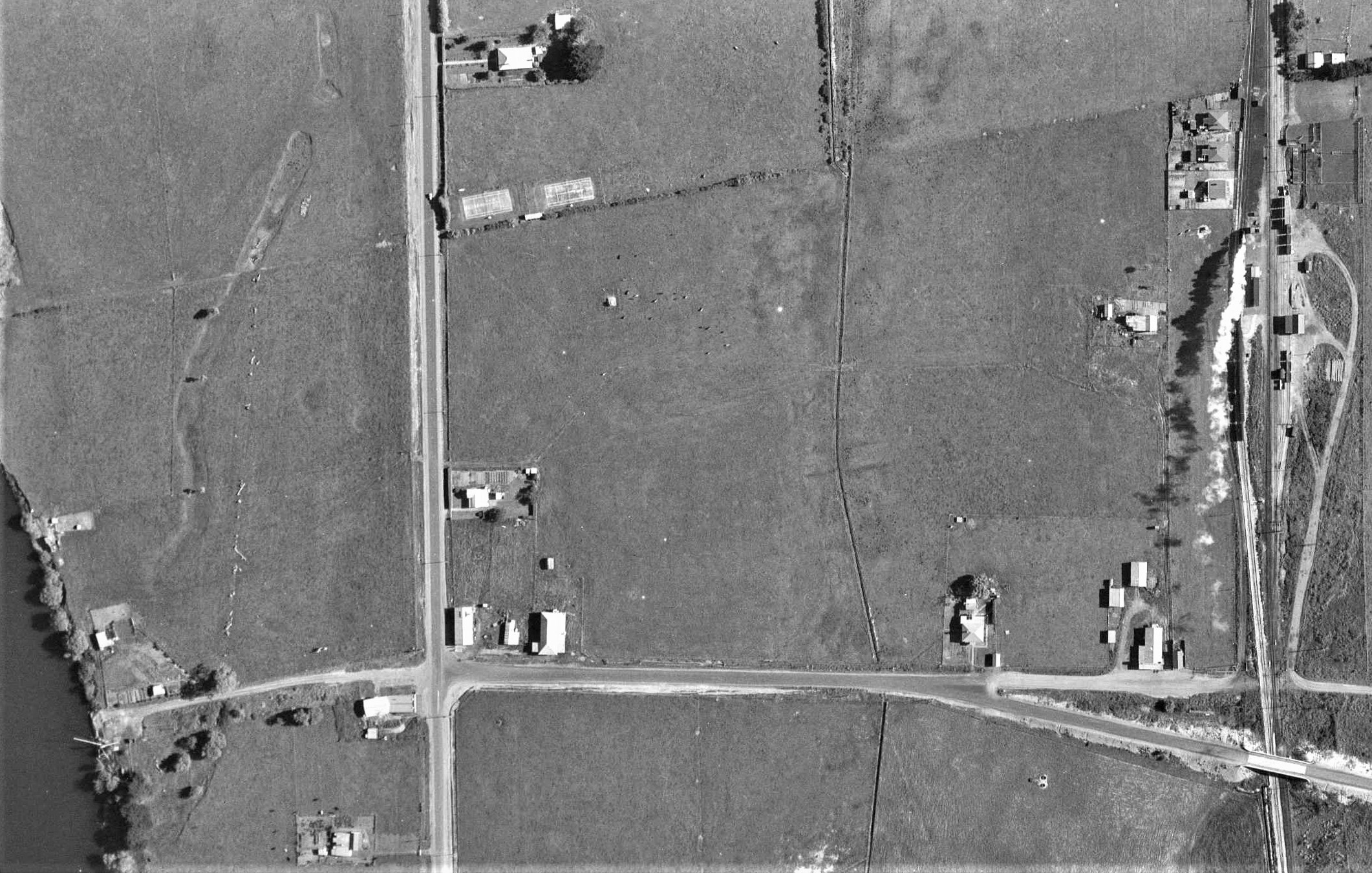
LINZ / Retrolens · 22 October 1940
This 1940 aerial shows the settlement, Waikato River, Great South Road and railway station before later road changes.
LINZ, sourced from Retrolens, via Wikimedia Commons. “1940 Ohinewai.jpg”.
CC BY 3.0. Wikimedia Commons file, source and licence details.
Download original image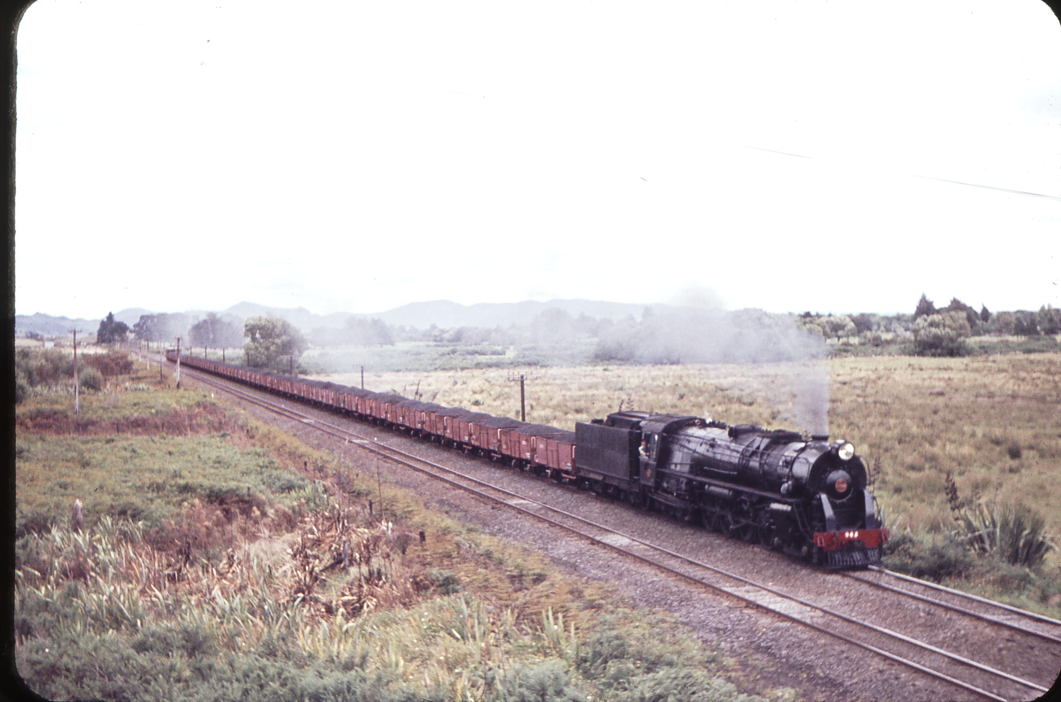
Weston Langford · 103994 · 15 January 1964
Langford’s catalogue identifies this as an up coal train at Ohinewai’s overhead bridge.
Weston Langford, 103994: Ohinewai Overhead bridge Up Coal Ka 942.
CC BY-ND 4.0. File reproduced without alteration. Photograph record and licence.
Download original image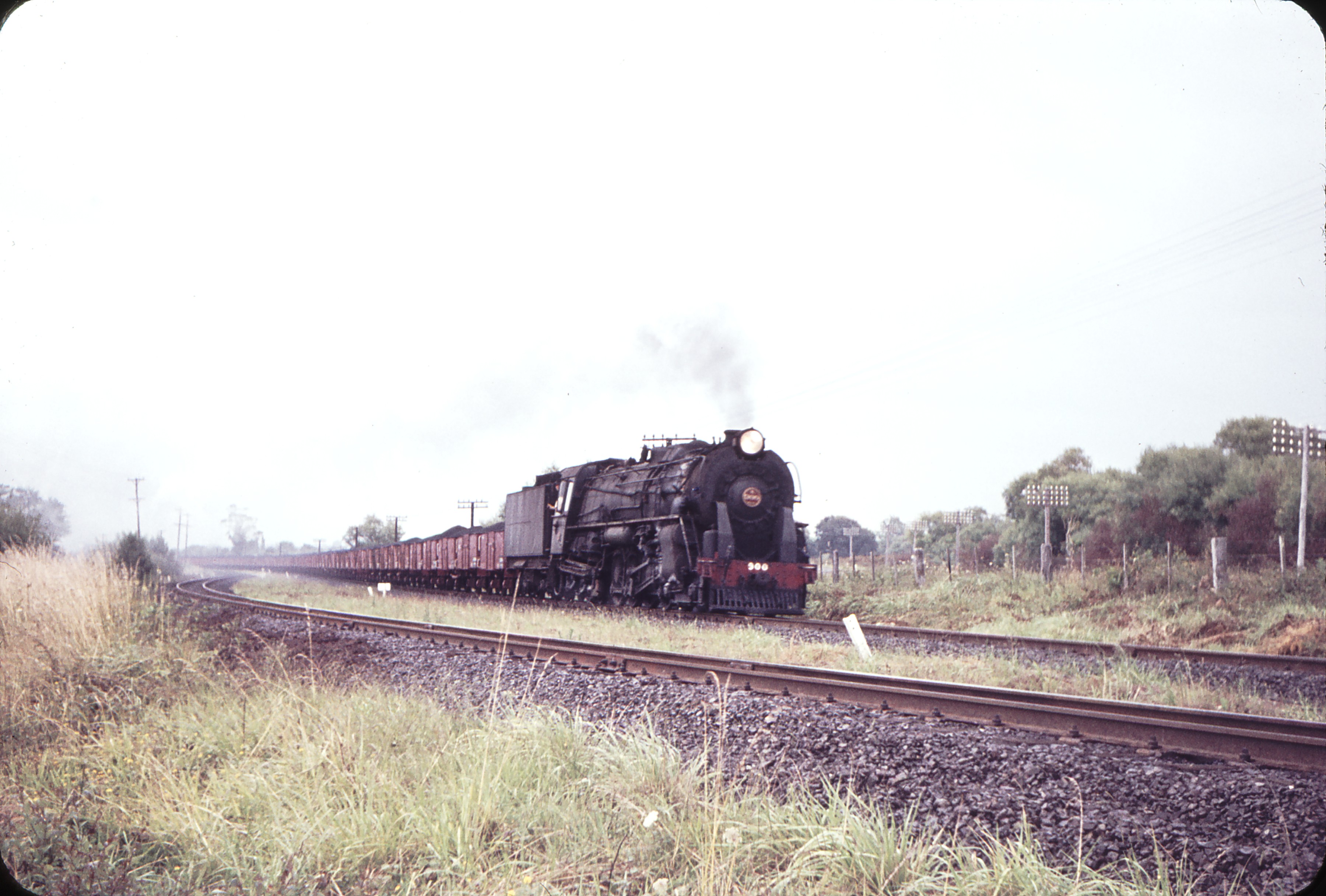
Weston Langford · 104003 · 15 January 1964
Langford’s caption places the photograph on the down side at Ohinewai, mile 61.5.
Weston Langford, 104003: Ohinewai down side Mile 61.5 Up Coal K 900.
CC BY-ND 4.0. File reproduced without alteration. Photograph record and licence.
Download original image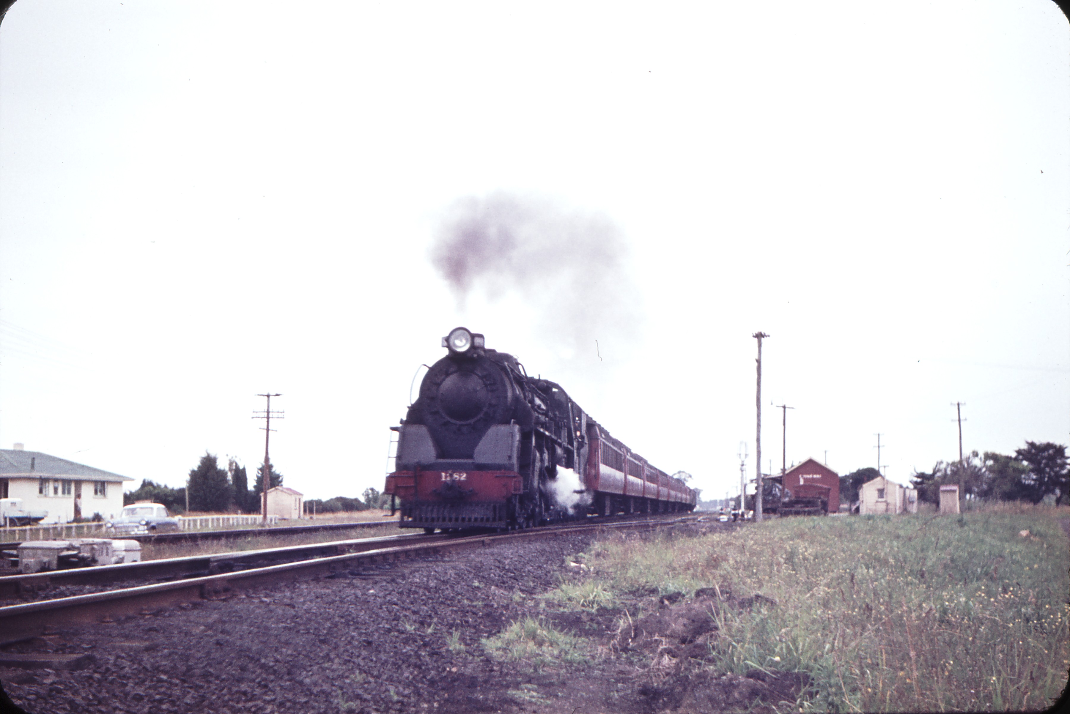
Weston Langford · 104004 · 15 January 1964
Homes, parked cars and the railway appear together in Langford’s photograph of the down express.
Weston Langford, 104004: Ohinewai Down Express Ja 1282.
CC BY-ND 4.0. File reproduced without alteration. Photograph record and licence.
Download original image